Article 2
Article 2
The second article by Hugh Cochran looks at the Diocese of Aberdeen as it was in 1560 and starts to identify the 15 churches that existed then between Banchory and Braemar.
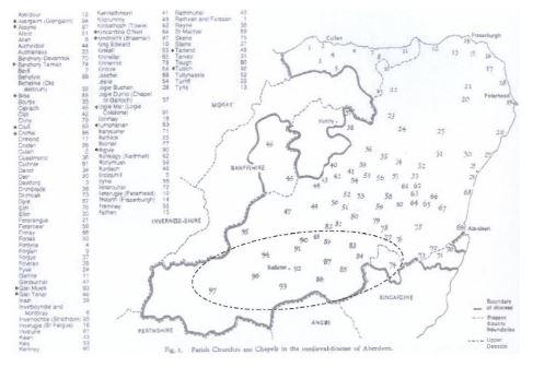
The oval dotted line on the plan encloses our 15 churches in Upper Deeside , but the reader will observe the unfamiliar boundary of the Diocese on its north western side where it included a strip along the Moray Firth, and a large part of what became Banffshire , but did not include Huntly and Strathbogie .The boundary of the Diocese and the County may have coincided originally, but frequent changes in recent years have left the two boundaries far apart. It is interesting however that before 1157, the Episcopal centre was at Mortlach, shown as No 46 on the map where there seems to have been a monasterium with five associated churches forming a minster type institution with a body of priests acting as the bishop’s familia and serving the subsidiary churches. This proto-diocese at Mortlach was at its height during the reign of David I (1124-1153) the very time that the parish system was being developed in Scotland, but the Papal Bull of 1157 brought huge changes. The bishop moved his seat from Mortlach to Aberdeen and by 1247 the existence of a Dean and Chapter had emerged, including a treasurer, a chanter, and a chancellor. All these new posts had to be paid for, and one of the earliest grants made for this purpose was by Duncan, Earl of Mar, gifting the church of Logie Mar (91 on our map) in 1239×1241. We have no details of the exact payment, but it will almost certainly have been of the whole teinds, parsonage and vicarage, payable to the cathedral chapter who will likely have ended up paying for a vicar pensioner at Logie Mar.
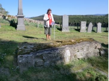
The church yard at Logie Mar was dedicated to St Neachtan and is situated at National Grid Ref NJ 422056 where there is no modern settlement, and there is no sign above ground of the church. However there is a burial ground still in use which contains an ancient carved stone cross slab dating to the 8th or 9th century now built in to a wall not thought to be the wall of the medieval church.
The Earl of Mar’s gift of this church to the Cathedral chapter probably left it desolate by the Reformation 300 years later.
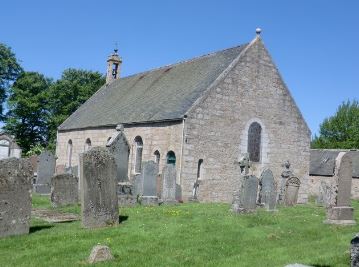
About the same time the churches of Auchterless, Birse and Daviot were given to the chanter, the chancellor, and the treasurer of the Diocese respectively. Birse Church is said to have been founded by and dedicated to St Colm, a follower of St Ninian, but latterly it was dedicated to St Michael. Birse was in a unique position in the diocese because in 1170 King William the Lion made a gift of the whole parish to Bishop Mathew of Aberdeen and his successors which meant that not only did the church have to pay its teinds etc to the chancellor, but every house and farm in the parish paid its rent to the Diocese. This was obviously a very beneficial arrangement for the Diocese, and it lasted right through to the Reformation. An interesting survival from that period is the Bishopric Rental Statement of 1511 which contains details of every farm in the parish, the name of every tenant, and particulars of the rents. The ruins of the Bishop’s hunting lodge can still be seen at Easter Clune on Finzean Estate, so successive bishops clearly indulged in the pleasures of their landownership. Alas, the ruins of the medieval church can no longer be seen. It is believed to have stood just next to the current Birse Church which can be seen at NGR NO 554973, (85 on our map) and is now used as a public hall and also for weddings and funerals.
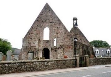
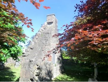
The most important church on Deeside at the time of the Reformation was Kincardine o’Neil, NGR NO 592996, (84 on our map) The original church built here is said to have been built by St Erchard in the 7th century. The ruin we see today however is not the ruin of that church but of another probably built in the early 14th century. It is the biggest and most interesting of all the medieval church ruins on Deeside. The site is important because of the nearby river crossing over the Dee where a bridge was built by the Durward family, of Coull, which led to a Spital also being built in 1231, whose ruined wall can still be seen at the east end of the church. The spital, that is a shelter for travellers, also served as a hospital for the sick, so we are looking at an important and valuable site comprising a church, a river crossing and a spital / hospital. There is evidence that a grant of revenue from the hospital was made by Bishop Kininmund to the Abbey of Kinloss in 1330. Not only will the hospital have generated its own revenue, but it was also possessed the revenues of the Church, and also the churches of Glen Tanar, Lumphanan, Cluny and Midmar.
So we can see in this one site how it sucked up the teinds from four other churches in the diocese, and passed them on to Kinloss Abbey, not even in the same diocese. The hospital / spital was no longer functioning at the time of the Reformation and the bridge had long since been washed away, but the church organisation was amended and it continued to be used as the local presbytery for mid Deeside by the reformed church right into the 19th century. Not much is known about the two Deeside churches that paid their teinds to Kincardine o’Neil. Glentanar (86 on our Map) stands 4km west of Aboyne on the south bank of the river Dee at NGR NO 476983. However this church is thought to date from the early 17th century, and the exact site of the pre-reformation church is not known. Lumphanan (83 on our map) NGR NJ 579038 is in much the same position as Glentanar, in that no sign of the earlier 7th and 13th century remains are visible. However, the siting of the church outside the modern village of Lumphanan is interesting. It is not far from the Peel Ring showing that the centre of population in medieval times was there and not where it moved to when the railway came to Lumphanan in the 19th century. The church is redundant now and in private ownership but it stands on the site of the church that was there when Macbeth drunk from the well that bears his name just behind it on the other side of the former railway track.
© Hugh Cochran 2013
Discover more…
